 vesseltracker.com
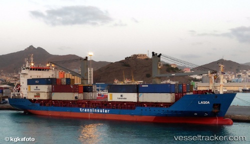
 LAGOA
LAGOA
Current Status
Where is the vessel?
LAGOA is currently in 99 nm N of Las Brujas, based on AIS data received less than 1h ago.
Latest AIS update:
Current position: 25.24432° N, 18.54884° W (99 nm N of Las Brujas)
Average speed (last 7 days): Loading…
Average speed (last 30 days): Loading…
Vessel profile: LAGOA is a General Cargo with dimensions m x m.
This page combines live AIS, route history, probable destination signals, nearby traffic, and port activity for practical vessel monitoring.
The current position of vessel LAGOA is 25.24432 lat / -18.54884 lng. Updated: 2026-05-16 12:08:24 UTCNearest reference points:
- 110 nm NE of Las Brujas
- 68 nm NW of Ad Dakhla
- 22 nm S of San Agustin
Currently sailing under the flag of Portugal ![]()
Details:
Live Vessel LAGOA Analytics (details, animations, etc.)
Recent AIS points (UTC):
2026-05-16 07:42:31 UTC · 26.11667, -17.86833 · SOG 14 kn · COG -1°2026-05-16 10:04:03 UTC · 25.64425, -18.23398 · SOG 14.4 kn · COG 217°
2026-05-16 10:06:29 UTC · 25.63500, -18.24000 · SOG 14 kn · COG -1°
2026-05-16 12:08:24 UTC · 25.24432, -18.54884 · SOG 14.2 kn · COG 218°