 vesseltracker.com
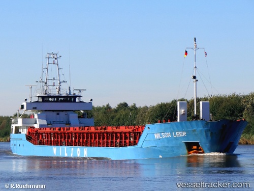
 WILSON LEER
Current Status
Where is the vessel?
WILSON LEER is currently in Near Blexen, based on AIS data received less than 1h ago.
Latest AIS update:
Current position: 53.52447° N, 8.56655° E (Near Blexen)
Average speed (last 7 days): Loading…
Average speed (last 30 days): Loading…
Vessel profile: WILSON LEER is a General Cargo with dimensions m x m.
This page combines live AIS, route history, probable destination signals, nearby traffic, and port activity for practical vessel monitoring.
The current position of vessel WILSON LEER is 53.52447 lat / 8.56655 lng. Updated: 2026-05-14 01:22:38 UTCNearest reference points:
- Near Bremerhaven
- Near Sandstedt
- Near Brake
Currently sailing under the flag of Bahamas ![]()
Details:
Live Vessel WILSON LEER Analytics (details, animations, etc.)
Recent AIS points (UTC):
2026-05-13 21:52:37 UTC · 53.52244, 8.56371 · SOG 0.1 kn · COG 63°2026-05-13 22:58:38 UTC · 53.52406, 8.56574 · SOG 0.1 kn · COG 205°
2026-05-13 23:52:37 UTC · 53.52455, 8.56606 · SOG 0.2 kn · COG 220°
2026-05-14 01:22:38 UTC · 53.52447, 8.56655 · SOG 0.3 kn · COG 224°