 vesseltracker.com
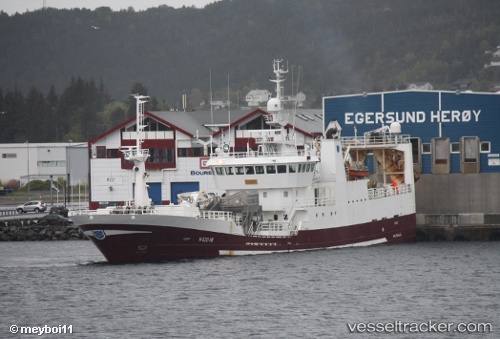
 Katrin Johanna
Current Status
Where is the vessel?
Katrin Johanna is currently in 55 nm SE of Thorshavn, based on AIS data received less than 1h ago.
Latest AIS update:
Current position: 61.44254° N, 4.54349° W (55 nm SE of Thorshavn)
Average speed (last 7 days): Loading…
Average speed (last 30 days): Loading…
Vessel profile: Katrin Johanna is a Fish Carrier with dimensions 73m x 13m.
This page combines live AIS, route history, probable destination signals, nearby traffic, and port activity for practical vessel monitoring.
The current position of vessel Katrin Johanna is 61.44254 lat / -4.54349 lng. Updated: 2026-05-15 01:10:00 UTCNearest reference points:
- 36 nm NW of Ham Voe, Foula
- 32 nm NW of Eshaness
- Near FUGLAFJORDUR
Currently sailing under the flag of Faroe Is ![]()
Katrin Johanna built in 1997 year
Deadweight:
2218 tDetails:
Live Vessel Katrin Johanna Analytics (details, animations, etc.)
Recent AIS points (UTC):
2026-05-14 22:21:59 UTC · 61.56041, -4.27931 · SOG 3.9 kn · COG 227°2026-05-14 22:56:01 UTC · 61.53358, -4.32768 · SOG 3.5 kn · COG 240°
2026-05-14 23:47:59 UTC · 61.50124, -4.41622 · SOG 3.8 kn · COG 254°
2026-05-15 01:10:00 UTC · 61.44254, -4.54349 · SOG 3.6 kn · COG 257°