 vesseltracker.com
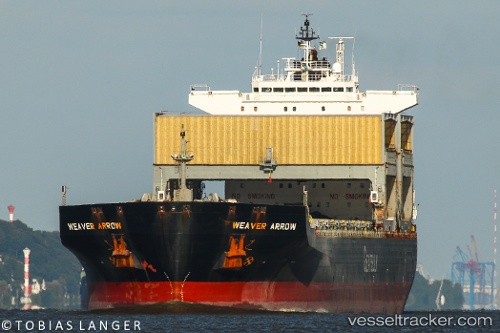
 Weaver Arrow
Current Status
Where is the vessel?
Weaver Arrow is currently in Near Bluff Harbor, based on AIS data received less than 1h ago.
Latest AIS update:
Current position: 46.59114° S, 168.34850° E (Near Bluff Harbor)
Average speed (last 7 days): Loading…
Average speed (last 30 days): Loading…
Vessel profile: Weaver Arrow is a Multi Purpose Carrier with dimensions 199m x 199m.
This page combines live AIS, route history, probable destination signals, nearby traffic, and port activity for practical vessel monitoring.
The current position of vessel Weaver Arrow is -46.59114 lat / 168.34850 lng. Updated: 2026-05-13 23:47:50 UTCCurrently sailing under the flag of Bahamas ![]()
Weaver Arrow built in 1998 year
Deadweight:
55402 tDetails:
Live Vessel Weaver Arrow Analytics (details, animations, etc.)
Recent AIS points (UTC):
2026-05-13 19:50:40 UTC · -46.59113, 168.34850 · SOG 0 kn · COG 146°2026-05-13 21:56:47 UTC · -46.59114, 168.34850 · SOG 0 kn · COG 146°
2026-05-13 22:29:42 UTC · -46.59114, 168.34850 · SOG 0 kn · COG 146°
2026-05-13 23:47:50 UTC · -46.59114, 168.34850 · SOG 0 kn · COG 146°