 vesseltracker.com
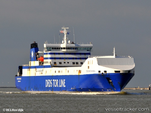
 Britannia Seaways
Current Status
Where is the vessel?
Britannia Seaways is currently in Near Town Quays/Drogheda, based on AIS data received less than 1h ago.
Latest AIS update:
Current position: 53.85063° N, 6.35527° E (Near Town Quays/Drogheda)
Average speed (last 7 days): Loading…
Average speed (last 30 days): Loading…
Vessel profile: Britannia Seaways is a Ro Ro Cargo Ship with dimensions 197m x 26m.
This page combines live AIS, route history, probable destination signals, nearby traffic, and port activity for practical vessel monitoring.
The current position of vessel Britannia Seaways is 53.85063 lat / 6.35527 lng. Updated: 2026-05-14 08:25:15 UTCNearest reference points:
- 14 nm NW of Town Quays/Drogheda
- Near Borkum
- Near Hoogkerk
Currently sailing under the flag of Denmark ![]()
Britannia Seaways built in 2000 year
Deadweight:
11089 tDetails:
Live Vessel Britannia Seaways Analytics (details, animations, etc.)
Recent AIS points (UTC):
2026-05-14 04:34:50 UTC · 54.01507, 8.12908 · SOG 17.2 kn · COG 273°2026-05-14 05:45:49 UTC · 54.01447, 7.57468 · SOG 16.5 kn · COG 258°
2026-05-14 08:00:01 UTC · 53.87160, 6.55487 · SOG 16.9 kn · COG 264°
2026-05-14 08:25:15 UTC · 53.85063, 6.35527 · SOG 17.5 kn · COG 257°