 vesseltracker.com
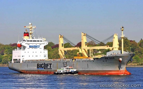
 Da Hua
Current Status
Where is the vessel?
Da Hua is currently in 38 nm S of Widuri, based on AIS data received about 1h ago.
Latest AIS update:
Current position: 5.28333° S, 106.54833° E (38 nm S of Widuri)
Average speed (last 7 days): Loading…
Average speed (last 30 days): Loading…
Vessel profile: Da Hua is a General Cargo Ship with dimensions 153m x 153m.
This page combines live AIS, route history, probable destination signals, nearby traffic, and port activity for practical vessel monitoring.
The current position of vessel Da Hua is -5.28333 lat / 106.54833 lng. Updated: 2026-05-14 20:14:37 UTCNearest reference points:
- 38 nm E of Kotatengah
- 19 nm N of Cilincing
- Near SURALAYA
Currently sailing under the flag of Panama ![]()
Da Hua built in 1998 year
Deadweight:
16957 tDetails:
Live Vessel Da Hua Analytics (details, animations, etc.)
Recent AIS points (UTC):
2026-05-14 16:56:36 UTC · -5.50667, 106.05500 · SOG 10 kn · COG -1°2026-05-14 18:05:37 UTC · -5.33667, 106.16500 · SOG 10 kn · COG -1°
2026-05-14 18:56:38 UTC · -5.27833, 106.30167 · SOG 11 kn · COG -1°
2026-05-14 20:14:37 UTC · -5.28333, 106.54833 · SOG 11 kn · COG -1°