 vesseltracker.com
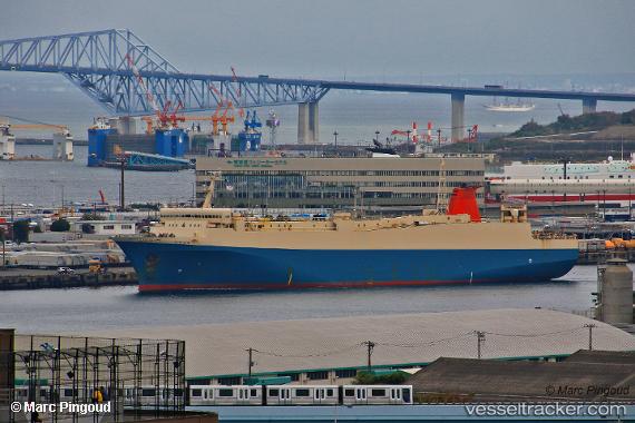
Akomar
Current StatusWhere is the vessel?
Akomar is currently in 30 nm NE of PENGERANG, based on AIS data received less than 1h ago.
Latest AIS update:
Current position: 1.60833° N, 104.59333° E (30 nm NE of PENGERANG)
Average speed (last 7 days): Loading…
Average speed (last 30 days): Loading…
Vessel profile: Akomar is a Passenger Ro Ro Cargo Ship with dimensions 24m x 156m.
This page combines live AIS, route history, probable destination signals, nearby traffic, and port activity for practical vessel monitoring.
The current position of vessel Akomar is 1.60833 lat / 104.59333 lng. Updated: 2026-05-14 14:22:59 UTCNearest reference points:
- 34 nm NE of PENGERANG
- 38 nm E of PENGERANG
- 45 nm NE of PENGERANG
Details:
Live Vessel Akomar Analytics (details, animations, etc.)
Recent AIS points (UTC):
2026-05-14 10:44:16 UTC · 1.33460, 104.37083 · SOG 5.7 kn · COG -1°2026-05-14 12:04:59 UTC · 1.42500, 104.44500 · SOG 5 kn · COG -1°
2026-05-14 13:20:06 UTC · 1.52167, 104.52333 · SOG 6 kn · COG -1°
2026-05-14 14:22:59 UTC · 1.60833, 104.59333 · SOG 6 kn · COG -1°