 vesseltracker.com
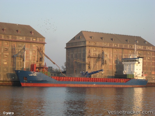
 Lister
Current Status
Where is the vessel?
Lister is currently in Near Beder, based on AIS data received about 1h ago.
Latest AIS update:
Current position: 56.10735° N, 10.36092° E (Near Beder)
Average speed (last 7 days): Loading…
Average speed (last 30 days): Loading…
Vessel profile: Lister is a Multi Purpose Carrier with dimensions 89m x 13m.
This page combines live AIS, route history, probable destination signals, nearby traffic, and port activity for practical vessel monitoring.
The current position of vessel Lister is 56.10735 lat / 10.36092 lng. Updated: 2026-05-15 07:37:01 UTCNearest reference points:
- Near Randers
- Near Glesborg
- Near Horsens
Currently sailing under the flag of Faroe Is ![]()
Lister built in 1997 year
Deadweight:
4113 tDetails:
Live Vessel Lister Analytics (details, animations, etc.)
Recent AIS points (UTC):
2026-05-15 04:40:04 UTC · 56.10731, 10.36083 · SOG 0.1 kn · COG 165°2026-05-15 06:19:03 UTC · 56.10736, 10.36088 · SOG 0.1 kn · COG 179°
2026-05-15 07:10:03 UTC · 56.10733, 10.36070 · SOG 0.1 kn · COG 167°
2026-05-15 07:37:01 UTC · 56.10735, 10.36092 · SOG 0.1 kn · COG 176°