 vesseltracker.com
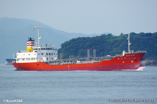
Xiang Shun
Current StatusWhere is the vessel?
Xiang Shun is currently in 22 nm S of Port de Boké, based on AIS data received less than 1h ago.
Latest AIS update:
Current position: 10.17326° N, 14.57785° W (22 nm S of Port de Boké)
Average speed (last 7 days): Loading…
Average speed (last 30 days): Loading…
Vessel profile: Xiang Shun is a Oil Products Tanker with dimensions 14m x 86m.
This page combines live AIS, route history, probable destination signals, nearby traffic, and port activity for practical vessel monitoring.
The current position of vessel Xiang Shun is 10.17326 lat / -14.57785 lng. Updated: 2026-05-14 09:40:08 UTCNearest reference points:
- 14 nm S of Port de Boké
- Near Port de Boké
- 49 nm S of Port de Boké
Details:
Live Vessel Xiang Shun Analytics (details, animations, etc.)
Recent AIS points (UTC):
2026-05-14 06:14:33 UTC · 10.20333, -14.46167 · SOG 0 kn · COG -1°2026-05-14 06:59:33 UTC · 10.20333, -14.46167 · SOG 0 kn · COG -1°
2026-05-14 07:17:34 UTC · 10.20333, -14.46167 · SOG 0 kn · COG -1°
2026-05-14 09:40:08 UTC · 10.17326, -14.57785 · SOG 5.5 kn · COG 255°