 vesseltracker.com
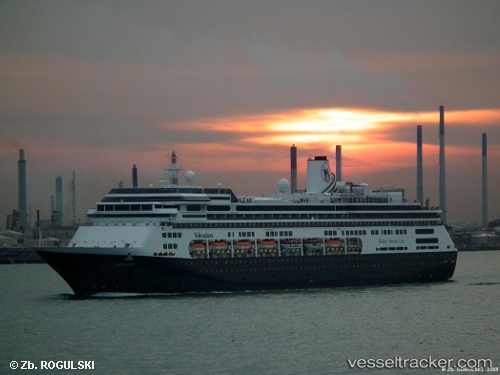
Volendam
Current StatusWhere is the vessel?
Volendam is currently in 50 nm S of Fort Hunter Liggett, based on AIS data received less than 1h ago.
Latest AIS update:
Current position: 35.14667° N, 122.07833° W (50 nm S of Fort Hunter Liggett)
Average speed (last 7 days): Loading…
Average speed (last 30 days): Loading…
Vessel profile: Volendam is a Cruise Ship with dimensions 32m x 238m.
This page combines live AIS, route history, probable destination signals, nearby traffic, and port activity for practical vessel monitoring.
The current position of vessel Volendam is 35.14667 lat / -122.07833 lng. Updated: 2026-05-02 14:17:10 UTCNearest reference points:
- Near Santa Barbara
Details:
Live Vessel Volendam Analytics (details, animations, etc.)
Recent AIS points (UTC):
2026-05-02 10:51:48 UTC · 35.99908, -122.50163 · SOG 15.8 kn · COG 147°2026-05-02 12:11:29 UTC · 35.67352, -122.33205 · SOG 16 kn · COG 158°
2026-05-02 13:52:10 UTC · 35.25340, -122.12944 · SOG 16.6 kn · COG 157°
2026-05-02 14:17:10 UTC · 35.14667, -122.07833 · SOG 16 kn · COG -1°