 vesseltracker.com
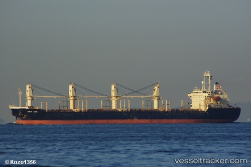
 BAO ANH
Current Status
Where is the vessel?
BAO ANH is currently in Near Kota Kinabalu, based on AIS data received about 1h ago.
Latest AIS update:
Current position: 6.08616° N, 116.12688° E (Near Kota Kinabalu)
Average speed (last 7 days): Loading…
Average speed (last 30 days): Loading…
Vessel profile: BAO ANH is a Bulk Carrier with dimensions 154m x 26m.
This page combines live AIS, route history, probable destination signals, nearby traffic, and port activity for practical vessel monitoring.
The current position of vessel BAO ANH is 6.08616 lat / 116.12688 lng. Updated: 2026-05-02 17:39:06 UTCNearest reference points:
- Near Kota Kinabalu
- 44 nm SW of Tembungo
- Near Kikeh
Currently sailing under the flag of Panama ![]()
BAO ANH built in 1997 year
Deadweight:
24102 tDetails:
Live Vessel BAO ANH Analytics (details, animations, etc.)
Recent AIS points (UTC):
2026-05-02 13:36:03 UTC · 6.08621, 116.12684 · SOG 0 kn · COG 107°2026-05-02 15:51:07 UTC · 6.08620, 116.12689 · SOG 0.2 kn · COG 107°
2026-05-02 16:33:04 UTC · 6.08617, 116.12687 · SOG 0 kn · COG 107°
2026-05-02 17:39:06 UTC · 6.08616, 116.12688 · SOG 0 kn · COG 107°