 Setuba
Current Status
Where is the vessel?
Setuba is currently in Near CIWANDAN, based on AIS data received about 16h ago.
Latest AIS update:
Current position: 5.98955° S, 105.93450° E (Near CIWANDAN)
Average speed (last 7 days): Loading…
Average speed (last 30 days): Loading…
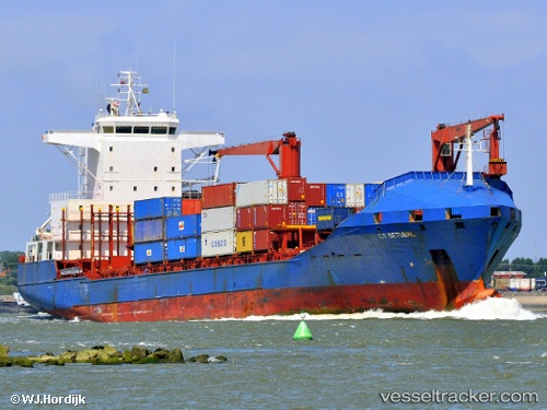
Vessel profile: Setuba is a Container Ship with dimensions 148m x 25m.
This page combines live AIS, route history, probable destination signals, nearby traffic, and port activity for practical vessel monitoring.
The current position of vessel Setuba is -5.98955 lat / 105.93450 lng. Updated: 2026-05-23 23:25:44 UTCNearest reference points:
- Near Cigading
- Near CIWANDAN
- Near MERAK
Currently sailing under the flag of Panama ![]()
Setuba built in 1997 year
Deadweight:
16727 tDetails:
Live Vessel Setuba Analytics (details, animations, etc.)
Recent AIS points (UTC):
2026-05-23 20:11:24 UTC · -5.94491, 105.93942 · SOG 8.5 kn · COG 195°2026-05-23 21:45:42 UTC · -5.98833, 105.93333 · SOG 0 kn · COG -1°
2026-05-23 22:04:43 UTC · -5.98900, 105.93395 · SOG 0 kn · COG 239°
2026-05-23 23:25:44 UTC · -5.98955, 105.93450 · SOG 0.1 kn · COG 248°