 vesseltracker.com
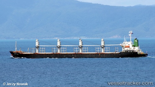
Tai Ho
Current StatusWhere is the vessel?
Tai Ho is currently in 47 nm SW of Kumul, based on AIS data received about 4h ago.
Latest AIS update:
Current position: 8.62027° S, 143.98326° E (47 nm SW of Kumul)
Average speed (last 7 days): Loading…
Average speed (last 30 days): Loading…
Vessel profile: Tai Ho is a Bulk Carrier with dimensions 27m x 169m.
This page combines live AIS, route history, probable destination signals, nearby traffic, and port activity for practical vessel monitoring.
The current position of vessel Tai Ho is -8.62027 lat / 143.98326 lng. Updated: 2026-04-28 09:04:19 UTCNearest reference points:
- 46 nm NW of Kopi
- Near Thursday Island
- Near Torres Strait
Details:
Live Vessel Tai Ho Analytics (details, animations, etc.)
Recent AIS points (UTC):
2026-04-28 05:37:11 UTC · -8.62015, 143.98499 · SOG 0 kn · COG 189°2026-04-28 09:04:19 UTC · -8.62027, 143.98326 · SOG 0.1 kn · COG 150°
2026-04-28 09:04:19 UTC · -8.62027, 143.98326 · SOG 0.1 kn · COG 150°
2026-04-28 09:04:19 UTC · -8.62027, 143.98326 · SOG 0.1 kn · COG 150°