 vesseltracker.com
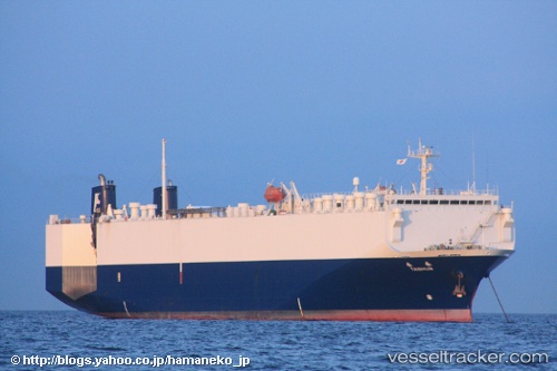
An Ji 11
Current StatusWhere is the vessel?
An Ji 11 is currently in Near Wu-Sung, based on AIS data received less than 1h ago.
Latest AIS update:
Current position: 31.36866° N, 121.62647° E (Near Wu-Sung)
Average speed (last 7 days): Loading…
Average speed (last 30 days): Loading…
Vessel profile: An Ji 11 is a Vehicles Carrier with dimensions 24m x 144m.
This page combines live AIS, route history, probable destination signals, nearby traffic, and port activity for practical vessel monitoring.
The current position of vessel An Ji 11 is 31.36866 lat / 121.62647 lng. Updated: 2026-05-13 19:59:54 UTCNearest reference points:
- Near Wu-Sung
- Near Gonglu
- Near Jinqiao
Details:
Live Vessel An Ji 11 Analytics (details, animations, etc.)
Recent AIS points (UTC):
2026-05-13 16:54:46 UTC · 31.09521, 121.99278 · SOG 7.1 kn · COG 299°2026-05-13 17:41:15 UTC · 31.15528, 121.88427 · SOG 8.7 kn · COG 304°
2026-05-13 19:35:25 UTC · 31.33704, 121.68587 · SOG 7.8 kn · COG 308°
2026-05-13 19:59:54 UTC · 31.36866, 121.62647 · SOG 8.6 kn · COG 295°