 vesseltracker.com
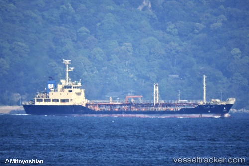
 Hanyu Nuri
Current Status
Where is the vessel?
Hanyu Nuri is currently in Near Boseong-gun, based on AIS data received less than 1h ago.
Latest AIS update:
Current position: 34.77639° N, 127.77571° E (Near Boseong-gun)
Average speed (last 7 days): Loading…
Average speed (last 30 days): Loading…
Vessel profile: Hanyu Nuri is a Chemical Oil Products Tanker with dimensions 70m x 12m.
This page combines live AIS, route history, probable destination signals, nearby traffic, and port activity for practical vessel monitoring.
The current position of vessel Hanyu Nuri is 34.77639 lat / 127.77571 lng. Updated: 2026-05-16 01:05:15 UTCNearest reference points:
- Near Boseong-gun
- Near Yeosu
- Near Sangam-dong
Currently sailing under the flag of Korea ![]()
Hanyu Nuri built in 1996 year
Deadweight:
1707 tDetails:
Live Vessel Hanyu Nuri Analytics (details, animations, etc.)
Recent AIS points (UTC):
2026-05-15 22:47:14 UTC · 34.77726, 127.77505 · SOG 0.1 kn · COG 113°2026-05-15 23:26:14 UTC · 34.77650, 127.77509 · SOG 0 kn · COG 38°
2026-05-16 01:05:15 UTC · 34.77639, 127.77571 · SOG 0 kn · COG 342°
2026-05-16 01:05:15 UTC · 34.77639, 127.77571 · SOG 0 kn · COG 342°