 vesseltracker.com
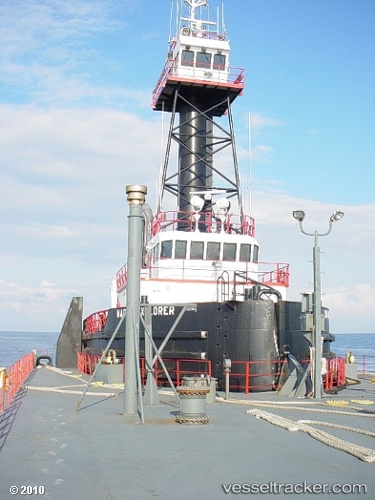
 MARTIN EXPLORER
Current Status
Where is the vessel?
MARTIN EXPLORER is currently in Near Norfolk, based on AIS data received about 1h ago.
Latest AIS update:
Current position: 36.83888° N, 76.28233° W (Near Norfolk)
Average speed (last 7 days): Loading…
Average speed (last 30 days): Loading…
Vessel profile: MARTIN EXPLORER is a Spare - Local Vessel with dimensions m x m.
This page combines live AIS, route history, probable destination signals, nearby traffic, and port activity for practical vessel monitoring.
The current position of vessel MARTIN EXPLORER is 36.83888 lat / -76.28233 lng. Updated: 2026-04-23 16:58:50 UTCNearest reference points:
- Near Norfolk
- Near Fentress
- Near Little Creek
Currently sailing under the flag of United States ![]()
Details:
Live Vessel MARTIN EXPLORER Analytics (details, animations, etc.)
Recent AIS points (UTC):
2026-04-23 13:34:00 UTC · 36.83888, -76.28231 · SOG 0 kn · COG 10°2026-04-23 13:42:26 UTC · 36.83888, -76.28233 · SOG 0 kn · COG 10°
2026-04-23 15:42:40 UTC · 36.83888, -76.28231 · SOG 0 kn · COG 11°
2026-04-23 16:58:50 UTC · 36.83888, -76.28233 · SOG 0 kn · COG 10°