 vesseltracker.com
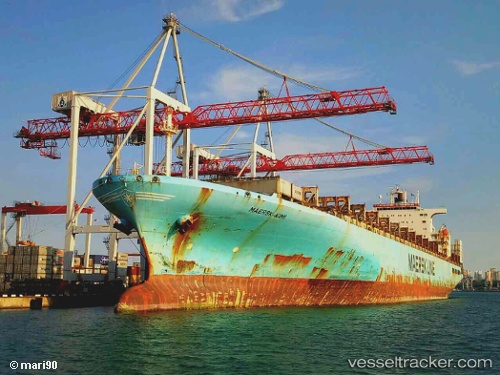
 MAERSK KIMI
Current Status
Where is the vessel?
MAERSK KIMI is currently in Near Bahía Las Minas, based on AIS data received about 1h ago.
Latest AIS update:
Current position: 9.45228° N, 79.86081° W (Near Bahía Las Minas)
Average speed (last 7 days): Loading…
Average speed (last 30 days): Loading…
Vessel profile: MAERSK KIMI is a Container Ship with dimensions 300m x 43m.
This page combines live AIS, route history, probable destination signals, nearby traffic, and port activity for practical vessel monitoring.
The current position of vessel MAERSK KIMI is 9.45228 lat / -79.86081 lng. Updated: 2026-05-15 13:47:58 UTCNearest reference points:
- Near COLON 2000
- Near Colon
- Near Colón Free Zone
Currently sailing under the flag of Liberia ![]()
MAERSK KIMI built in 1998 year
Deadweight:
94769 tDetails:
Live Vessel MAERSK KIMI Analytics (details, animations, etc.)
Recent AIS points (UTC):
2026-05-15 10:54:17 UTC · 9.45248, -79.86070 · SOG 0 kn · COG 285°2026-05-15 11:26:55 UTC · 9.45248, -79.86070 · SOG 0 kn · COG 285°
2026-05-15 13:46:20 UTC · 9.45234, -79.86081 · SOG 0.1 kn · COG 291°
2026-05-15 13:47:58 UTC · 9.45228, -79.86081 · SOG 0 kn · COG 291°