 vesseltracker.com
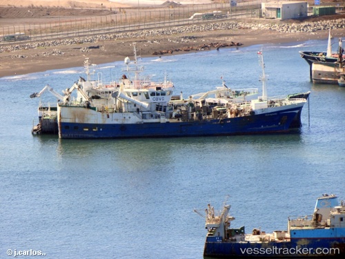
Vesterveg
Current StatusWhere is the vessel?
Vesterveg is currently in Near Coronel, based on AIS data received less than 1h ago.
Latest AIS update:
Current position: 37.03110° S, 73.16116° W (Near Coronel)
Average speed (last 7 days): Loading…
Average speed (last 30 days): Loading…
Vessel profile: Vesterveg is a Fish Carrier with dimensions 12m x 60m.
This page combines live AIS, route history, probable destination signals, nearby traffic, and port activity for practical vessel monitoring.
The current position of vessel Vesterveg is -37.03110 lat / -73.16116 lng. Updated: 2026-05-14 18:04:24 UTCNearest reference points:
- Near Arauco
Details:
Live Vessel Vesterveg Analytics (details, animations, etc.)
Recent AIS points (UTC):
2026-05-14 14:17:05 UTC · -37.02781, -73.16235 · SOG 0.1 kn · COG 184°2026-05-14 16:23:35 UTC · -37.03110, -73.16116 · SOG 0.1 kn · COG 227°
2026-05-14 16:51:45 UTC · -37.03106, -73.16116 · SOG 0 kn · COG 222°
2026-05-14 18:04:24 UTC · -37.03110, -73.16116 · SOG 0.1 kn · COG 245°