 vesseltracker.com
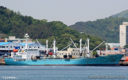
Badaro
Current StatusWhere is the vessel?
Badaro is currently in 310 nm NE of Nonouti, based on AIS data received less than 1h ago.
Latest AIS update:
Current position: 2.51370° N, 178.50101° E (310 nm NE of Nonouti)
Average speed (last 7 days): Loading…
Average speed (last 30 days): Loading…
Vessel profile: Badaro is a Refrigerated Cargo Ship with dimensions 10m x 120m.
This page combines live AIS, route history, probable destination signals, nearby traffic, and port activity for practical vessel monitoring.
The current position of vessel Badaro is 2.51370 lat / 178.50101 lng. Updated: 2026-05-15 01:23:11 UTCNearest reference points:
- 358 nm NE of Nonouti
- Open sea, approx. 400 nm off the nearest listed port
- Open sea, approx. 404 nm off the nearest listed port
Details:
Live Vessel Badaro Analytics (details, animations, etc.)
Recent AIS points (UTC):
2026-05-14 22:07:48 UTC · 2.51220, 178.50121 · SOG 0.3 kn · COG 304°2026-05-14 22:08:47 UTC · 2.51220, 178.50128 · SOG 0.3 kn · COG 306°
2026-05-14 23:26:55 UTC · 2.51404, 178.50400 · SOG 0.1 kn · COG 326°
2026-05-15 01:23:11 UTC · 2.51370, 178.50101 · SOG 0.1 kn · COG 124°