 vesseltracker.com
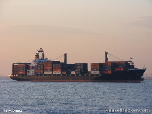
 Kanway Galaxy
Current Status
Where is the vessel?
Kanway Galaxy is currently in 25 nm NW of Hongdo, based on AIS data received less than 1h ago.
Latest AIS update:
Current position: 34.93486° N, 124.81209° E (25 nm NW of Hongdo)
Average speed (last 7 days): Loading…
Average speed (last 30 days): Loading…
Vessel profile: Kanway Galaxy is a Container Ship with dimensions 193m x 28m.
This page combines live AIS, route history, probable destination signals, nearby traffic, and port activity for practical vessel monitoring.
The current position of vessel Kanway Galaxy is 34.93486 lat / 124.81209 lng. Updated: 2026-05-15 07:49:30 UTCNearest reference points:
- 77 nm W of Hongdo
- 93 nm SE of SHIDAO
- 19 nm NW of Sangwangdeungdo
Currently sailing under the flag of Panama ![]()
Kanway Galaxy built in 1997 year
Deadweight:
24386 tDetails:
Live Vessel Kanway Galaxy Analytics (details, animations, etc.)
Recent AIS points (UTC):
2026-05-15 05:01:35 UTC · 34.28677, 125.14427 · SOG 15.4 kn · COG 344°2026-05-15 05:48:12 UTC · 34.47522, 125.05336 · SOG 15.2 kn · COG 339°
2026-05-15 07:06:00 UTC · 34.77266, 124.89749 · SOG 14.6 kn · COG 337°
2026-05-15 07:49:30 UTC · 34.93486, 124.81209 · SOG 14.4 kn · COG 340°