 vesseltracker.com
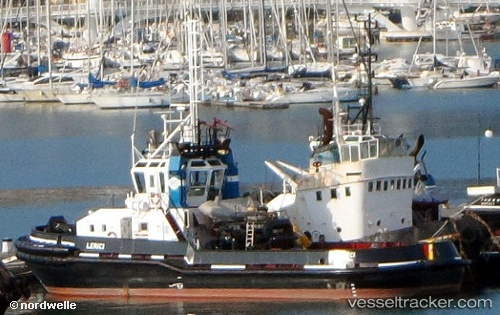
 TENSIFT
Current Status
Where is the vessel?
TENSIFT is currently in Near Nouveau Port Safi, Sidi Boudenyan, based on AIS data received about 7h ago.
Latest AIS update:
Current position: 32.17104° N, 9.26897° W (Near Nouveau Port Safi, Sidi Boudenyan)
Average speed (last 7 days): Loading…
Average speed (last 30 days): Loading…
Vessel profile: TENSIFT is a Tug with dimensions 10m x 31m.
This page combines live AIS, route history, probable destination signals, nearby traffic, and port activity for practical vessel monitoring.
The current position of vessel TENSIFT is 32.17104 lat / -9.26897 lng. Updated: 2026-05-16 05:19:41 UTCNearest reference points:
- 32 nm NW of Safi
- 52 nm NW of Safi
- Near Jorf Lasfar
Currently sailing under the flag of Morocco ![]()
TENSIFT built in 1998 year
Deadweight:
180 tDetails:
Live Vessel TENSIFT Analytics (details, animations, etc.)
Recent AIS points (UTC):
2026-05-16 05:19:41 UTC · 32.17104, -9.26897 · SOG 0 kn · COG -1°2026-05-16 05:19:41 UTC · 32.17104, -9.26897 · SOG 0 kn · COG -1°
2026-05-16 05:19:41 UTC · 32.17104, -9.26897 · SOG 0 kn · COG -1°
2026-05-16 05:19:41 UTC · 32.17104, -9.26897 · SOG 0 kn · COG -1°