 vesseltracker.com
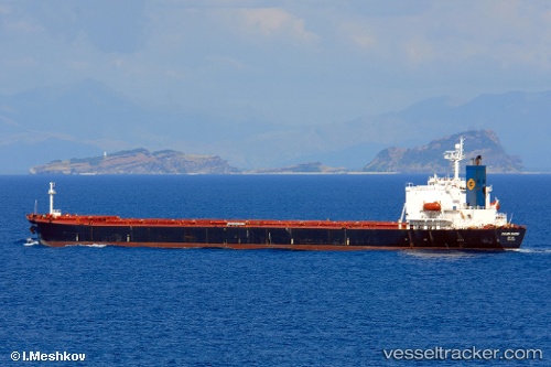
Den Sha
Current StatusWhere is the vessel?
Den Sha is currently in 150 nm W of Salomague, based on AIS data received about 2h ago.
Latest AIS update:
Current position: 18.12776° N, 117.80705° E (150 nm W of Salomague)
Average speed (last 7 days): Loading…
Average speed (last 30 days): Loading…
Vessel profile: Den Sha is a Bulk Carrier with dimensions 32m x 225m.
This page combines live AIS, route history, probable destination signals, nearby traffic, and port activity for practical vessel monitoring.
The current position of vessel Den Sha is 18.12776 lat / 117.80705 lng. Updated: 2026-05-16 03:44:07 UTCNearest reference points:
- 138 nm NW of Bolinao
- 148 nm SE of Xijiang
- 22 nm W of Salomague
Details:
Live Vessel Den Sha Analytics (details, animations, etc.)
Recent AIS points (UTC):
2026-05-16 01:09:01 UTC · 17.76788, 117.49741 · SOG 10.7 kn · COG 45°2026-05-16 01:09:01 UTC · 17.76788, 117.49741 · SOG 10.7 kn · COG 45°
2026-05-16 03:03:10 UTC · 18.03033, 117.72290 · SOG 10.9 kn · COG 42°
2026-05-16 03:44:07 UTC · 18.12776, 117.80705 · SOG 11.2 kn · COG 41°