 vesseltracker.com
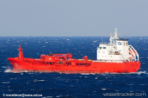
 Inebolu
Current Status
Where is the vessel?
Inebolu is currently in 70 nm SW of Areópolis, based on AIS data received about 2h ago.
Latest AIS update:
Current position: 35.63128° N, 21.68459° E (70 nm SW of Areópolis)
Average speed (last 7 days): Loading…
Average speed (last 30 days): Loading…
Vessel profile: Inebolu is a Chemical Oil Products Tanker with dimensions 103m x 17m.
This page combines live AIS, route history, probable destination signals, nearby traffic, and port activity for practical vessel monitoring.
The current position of vessel Inebolu is 35.63128 lat / 21.68459 lng. Updated: 2026-05-15 10:04:57 UTCNearest reference points:
- 23 nm S of Methoni
- 85 nm W of Paleochora
- 59 nm W of Paleochora
Currently sailing under the flag of Malta ![]()
Inebolu built in 1999 year
Deadweight:
6008 tDetails:
Live Vessel Inebolu Analytics (details, animations, etc.)
Recent AIS points (UTC):
2026-05-15 07:15:06 UTC · 35.40788, 22.28590 · SOG 11.1 kn · COG 293°2026-05-15 08:19:59 UTC · 35.48611, 22.05943 · SOG 11.4 kn · COG 301°
2026-05-15 10:04:57 UTC · 35.63128, 21.68459 · SOG 11.7 kn · COG 294°
2026-05-15 10:04:57 UTC · 35.63128, 21.68459 · SOG 11.7 kn · COG 294°