 vesseltracker.com
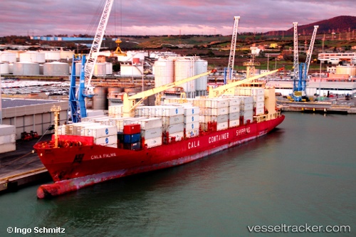
 Cala Palma
Current Status
Where is the vessel?
Cala Palma is currently in Near TURBO, based on AIS data received less than 1h ago.
Latest AIS update:
Current position: 7.97826° N, 76.78191° W (Near TURBO)
Average speed (last 7 days): Loading…
Average speed (last 30 days): Loading…
Vessel profile: Cala Palma is a Refrigerated Cargo Ship with dimensions 190m x 190m.
This page combines live AIS, route history, probable destination signals, nearby traffic, and port activity for practical vessel monitoring.
The current position of vessel Cala Palma is 7.97826 lat / -76.78191 lng. Updated: 2026-05-14 11:25:08 UTCNearest reference points:
- 15 nm NE of Capurgana
- 62 nm NE of Playón Chico
- Near Saboga
Currently sailing under the flag of Italy ![]()
Cala Palma built in 2000 year
Deadweight:
16024 tDetails:
Live Vessel Cala Palma Analytics (details, animations, etc.)
Recent AIS points (UTC):
2026-05-14 07:58:20 UTC · 7.97800, -76.78258 · SOG 0 kn · COG 349°2026-05-14 10:19:10 UTC · 7.97810, -76.78275 · SOG 0.1 kn · COG 9°
2026-05-14 10:28:19 UTC · 7.97832, -76.78250 · SOG 0.1 kn · COG 5°
2026-05-14 11:25:08 UTC · 7.97826, -76.78191 · SOG 0.1 kn · COG 326°