 vesseltracker.com
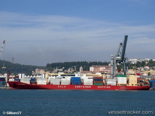
Cala Pedra
Current StatusWhere is the vessel?
Cala Pedra is currently in Near Tarragona, based on AIS data received less than 1h ago.
Latest AIS update:
Current position: 41.10573° N, 1.23660° E (Near Tarragona)
Average speed (last 7 days): Loading…
Average speed (last 30 days): Loading…
Vessel profile: Cala Pedra is a Refrigerated Cargo Ship with dimensions 24m x 189m.
This page combines live AIS, route history, probable destination signals, nearby traffic, and port activity for practical vessel monitoring.
The current position of vessel Cala Pedra is 41.10573 lat / 1.23660 lng. Updated: 2026-05-14 14:06:35 UTCNearest reference points:
- Near Tarragona
- Near Salou
- Near CAMBRILS
Details:
Live Vessel Cala Pedra Analytics (details, animations, etc.)
Recent AIS points (UTC):
2026-05-14 10:41:24 UTC · 41.10576, 1.23663 · SOG 0.2 kn · COG 168°2026-05-14 11:36:35 UTC · 41.10571, 1.23660 · SOG 0 kn · COG 166°
2026-05-14 13:45:47 UTC · 41.10571, 1.23658 · SOG 0 kn · COG 167°
2026-05-14 14:06:35 UTC · 41.10573, 1.23660 · SOG 0 kn · COG 166°