 vesseltracker.com
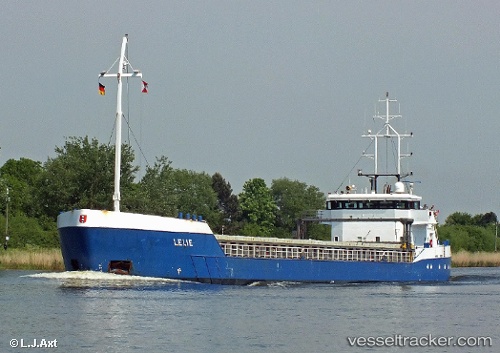
 Lelie C
Current Status
Where is the vessel?
Lelie C is currently in 50 nm S of Claonaig, based on AIS data received about 1h ago.
Latest AIS update:
Current position: 54.92833° N, 5.20667° E (50 nm S of Claonaig)
Average speed (last 7 days): Loading…
Average speed (last 30 days): Loading…
Vessel profile: Lelie C is a Multi Purpose Carrier with dimensions 88m x 11m.
This page combines live AIS, route history, probable destination signals, nearby traffic, and port activity for practical vessel monitoring.
The current position of vessel Lelie C is 54.92833 lat / 5.20667 lng. Updated: 2026-05-14 13:53:40 UTCNearest reference points:
- 14 nm NW of Town Quays/Drogheda
- Near HARLINGEN
- Near FRANEKER
Currently sailing under the flag of Netherlands ![]()
Lelie C built in 2000 year
Deadweight:
3697 tDetails:
Live Vessel Lelie C Analytics (details, animations, etc.)
Recent AIS points (UTC):
2026-05-14 10:23:43 UTC · 55.46833, 5.35333 · SOG 9 kn · COG -1°2026-05-14 11:32:40 UTC · 55.29167, 5.30333 · SOG 9 kn · COG -1°
2026-05-14 13:43:25 UTC · 54.95540, 5.21357 · SOG 9.4 kn · COG 186°
2026-05-14 13:53:40 UTC · 54.92833, 5.20667 · SOG 9 kn · COG -1°