 vesseltracker.com
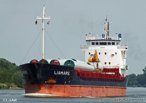
 Liamare
Current Status
Where is the vessel?
Liamare is currently in Near Hauge i Dalane, based on AIS data received less than 1h ago.
Latest AIS update:
Current position: 58.32793° N, 6.26102° E (Near Hauge i Dalane)
Average speed (last 7 days): Loading…
Average speed (last 30 days): Loading…
Vessel profile: Liamare is a General Cargo Ship with dimensions 108m x 15m.
This page combines live AIS, route history, probable destination signals, nearby traffic, and port activity for practical vessel monitoring.
The current position of vessel Liamare is 58.32793 lat / 6.26102 lng. Updated: 2026-04-19 21:38:10 UTCNearest reference points:
- Near Åna-Sira
- Near Egersund
- Near Kirkehamn
Currently sailing under the flag of Netherlands ![]()
Liamare built in 2001 year
Deadweight:
5842 tDetails:
Live Vessel Liamare Analytics (details, animations, etc.)
Recent AIS points (UTC):
2026-04-19 17:41:12 UTC · 58.32793, 6.26100 · SOG 0 kn · COG 240°2026-04-19 19:47:12 UTC · 58.32793, 6.26102 · SOG 0 kn · COG 239°
2026-04-19 19:50:10 UTC · 58.32793, 6.26102 · SOG 0.1 kn · COG 239°
2026-04-19 21:38:10 UTC · 58.32793, 6.26102 · SOG 0 kn · COG 240°