 vesseltracker.com
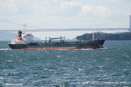
 ARAHAN
Current Status
Where is the vessel?
ARAHAN is currently in 62 nm SW of Kendawangan, based on AIS data received about 3d ago.
Latest AIS update:
Current position: 3.25469° S, 109.46394° E (62 nm SW of Kendawangan)
Average speed (last 7 days): Loading…
Average speed (last 30 days): Loading…
Vessel profile: ARAHAN is a Oil/Chemical Tanker with dimensions m x m.
This page combines live AIS, route history, probable destination signals, nearby traffic, and port activity for practical vessel monitoring.
The current position of vessel ARAHAN is -3.25469 lat / 109.46394 lng. Updated: 2026-05-10 16:23:38 UTCNearest reference points:
- 45 nm SW of Kendawangan
- 39 nm NW of Kendawangan
- 20 nm N of Kendawangan
Currently sailing under the flag of Indonesia ![]()
Details:
Live Vessel ARAHAN Analytics (details, animations, etc.)
Recent AIS points (UTC):
2026-05-10 16:23:38 UTC · -3.25469, 109.46394 · SOG 8.8 kn · COG 35°2026-05-10 16:23:38 UTC · -3.25469, 109.46394 · SOG 8.8 kn · COG 35°
2026-05-10 16:23:38 UTC · -3.25469, 109.46394 · SOG 8.8 kn · COG 35°
2026-05-10 16:23:38 UTC · -3.25469, 109.46394 · SOG 8.8 kn · COG 35°