 vesseltracker.com
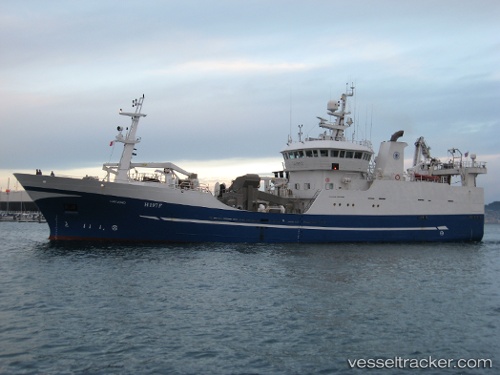
Viking
Current StatusWhere is the vessel?
Viking is currently in Near Gamcheon/Busan, based on AIS data received about 1h ago.
Latest AIS update:
Current position: 35.08006° N, 128.99303° E (Near Gamcheon/Busan)
Average speed (last 7 days): Loading…
Average speed (last 30 days): Loading…
Vessel profile: Viking is a Fishing Vessel with dimensions 13m x 65m.
This page combines live AIS, route history, probable destination signals, nearby traffic, and port activity for practical vessel monitoring.
The current position of vessel Viking is 35.08006 lat / 128.99303 lng. Updated: 2026-05-14 11:57:34 UTCNearest reference points:
- Near Gamcheon/Busan
- Near Busan
- Near BUSAN NEW PORT
Details:
Live Vessel Viking Analytics (details, animations, etc.)
Recent AIS points (UTC):
2026-05-14 07:51:34 UTC · 35.08008, 128.99303 · SOG 0 kn · COG 71°2026-05-14 10:27:34 UTC · 35.08007, 128.99303 · SOG 0 kn · COG 73°
2026-05-14 11:00:35 UTC · 35.08009, 128.99304 · SOG 0 kn · COG 72°
2026-05-14 11:57:34 UTC · 35.08006, 128.99303 · SOG 0 kn · COG 74°