 vesseltracker.com
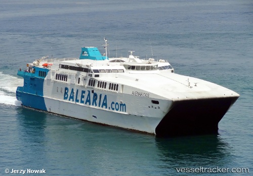
 Avemar Dos
Current Status
Where is the vessel?
Avemar Dos is currently in Near Strait Of Gibraltar, based on AIS data received less than 1h ago.
Latest AIS update:
Current position: 35.88170° N, 5.77226° W (Near Strait Of Gibraltar)
Average speed (last 7 days): Loading…
Average speed (last 30 days): Loading…
Vessel profile: Avemar Dos is a Passenger Ro Ro Cargo Ship with dimensions 82m x 23m.
This page combines live AIS, route history, probable destination signals, nearby traffic, and port activity for practical vessel monitoring.
The current position of vessel Avemar Dos is 35.88170 lat / -5.77226 lng. Updated: 2026-05-16 07:47:35 UTCNearest reference points:
- Near TARIFA
- Near TANGER MED
- Near Algeciras
Currently sailing under the flag of Spain ![]()
Avemar Dos built in 1997 year
Deadweight:
340 tDetails:
Live Vessel Avemar Dos Analytics (details, animations, etc.)
Recent AIS points (UTC):
2026-05-16 05:09:12 UTC · 36.01008, -5.60326 · SOG 0 kn · COG 248°2026-05-16 05:51:22 UTC · 36.01007, -5.60325 · SOG 0 kn · COG 248°
2026-05-16 07:18:23 UTC · 36.00384, -5.60382 · SOG 6 kn · COG 164°
2026-05-16 07:47:35 UTC · 35.88170, -5.77226 · SOG 27.7 kn · COG 188°