 vesseltracker.com
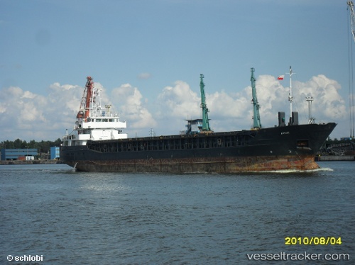
 ENDEAVOUR
Current Status
Where is the vessel?
ENDEAVOUR is currently in Near Ventspils, based on AIS data received less than 1h ago.
Latest AIS update:
Current position: 57.39976° N, 21.58173° E (Near Ventspils)
Average speed (last 7 days): Loading…
Average speed (last 30 days): Loading…
Vessel profile: ENDEAVOUR is a General Cargo with dimensions m x m.
This page combines live AIS, route history, probable destination signals, nearby traffic, and port activity for practical vessel monitoring.
The current position of vessel ENDEAVOUR is 57.39976 lat / 21.58173 lng. Updated: 2026-05-15 13:39:44 UTCNearest reference points:
- 11 nm N of Ventspils
- Near Ventspils
- 18 nm N of Ventspils
Currently sailing under the flag of Saint Kitts and Nevis ![]()
Details:
Live Vessel ENDEAVOUR Analytics (details, animations, etc.)
Recent AIS points (UTC):
2026-05-15 09:40:43 UTC · 57.39977, 21.58173 · SOG 0 kn · COG 321°2026-05-15 10:28:24 UTC · 57.39984, 21.58165 · SOG 0 kn · COG 320°
2026-05-15 11:40:33 UTC · 57.39981, 21.58165 · SOG 0 kn · COG 320°
2026-05-15 13:39:44 UTC · 57.39976, 21.58173 · SOG 0 kn · COG 320°