 vesseltracker.com
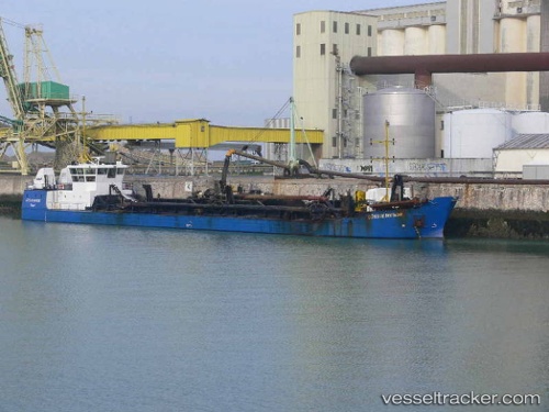
 Cotes De Bretagne
Current Status
Where is the vessel?
Cotes De Bretagne is currently in Near Concarneau, based on AIS data received about 10h ago.
Latest AIS update:
Current position: 47.87752° N, 3.90546° W (Near Concarneau)
Average speed (last 7 days): Loading…
Average speed (last 30 days): Loading…
Vessel profile: Cotes De Bretagne is a Hopper Dredger with dimensions 75m x 11m.
This page combines live AIS, route history, probable destination signals, nearby traffic, and port activity for practical vessel monitoring.
The current position of vessel Cotes De Bretagne is 47.87752 lat / -3.90546 lng. Updated: 2026-04-25 18:12:24 UTCNearest reference points:
- Near Névez
- Near Loctudy
- Near Lorient
Currently sailing under the flag of France ![]()
Cotes De Bretagne built in 1998 year
Deadweight:
2400 tDetails:
Live Vessel Cotes De Bretagne Analytics (details, animations, etc.)
Recent AIS points (UTC):
2026-04-25 18:12:24 UTC · 47.87752, -3.90546 · SOG 0 kn · COG -1°2026-04-25 18:12:24 UTC · 47.87752, -3.90546 · SOG 0 kn · COG -1°
2026-04-25 18:12:24 UTC · 47.87752, -3.90546 · SOG 0 kn · COG -1°
2026-04-25 18:12:24 UTC · 47.87752, -3.90546 · SOG 0 kn · COG -1°