 vesseltracker.com
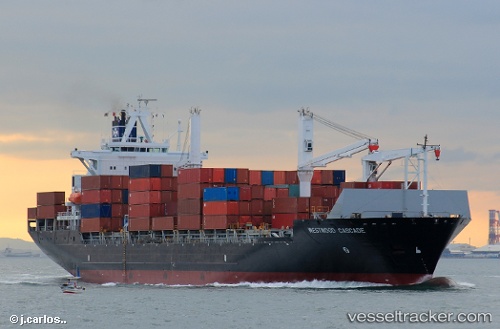
 Thorswind
Current Status
Where is the vessel?
Thorswind is currently in 37 nm SE of Beira, based on AIS data received less than 1h ago.
Latest AIS update:
Current position: 20.16123° S, 35.37477° E (37 nm SE of Beira)
Average speed (last 7 days): Loading…
Average speed (last 30 days): Loading…
Vessel profile: Thorswind is a Container Ship with dimensions 183m x 30m.
This page combines live AIS, route history, probable destination signals, nearby traffic, and port activity for practical vessel monitoring.
The current position of vessel Thorswind is -20.16123 lat / 35.37477 lng. Updated: 2026-05-14 21:33:11 UTCNearest reference points:
- 24 nm SE of Beira
- 21 nm SE of Beira
- 14 nm E of Beira
Currently sailing under the flag of Liberia ![]()
Thorswind built in 1999 year
Deadweight:
30046 tDetails:
Live Vessel Thorswind Analytics (details, animations, etc.)
Recent AIS points (UTC):
2026-05-14 18:21:09 UTC · -20.16128, 35.37812 · SOG 0 kn · COG -1°2026-05-14 19:39:10 UTC · -20.16048, 35.37586 · SOG 0 kn · COG -1°
2026-05-14 19:48:10 UTC · -20.16050, 35.37575 · SOG 0 kn · COG 154°
2026-05-14 21:33:11 UTC · -20.16123, 35.37477 · SOG 0 kn · COG -1°