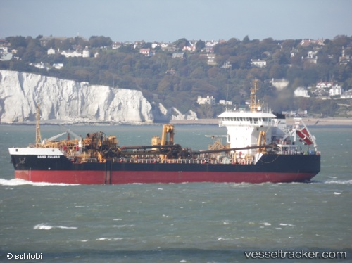
 SAND FULMAR
Current Status
Where is the vessel?
SAND FULMAR is currently in Near Harrietsham, based on AIS data received about 16h ago.
Latest AIS update:
Current position: 51.48861° N, 1.16718° E (Near Harrietsham)
Average speed (last 7 days): Loading…
Average speed (last 30 days): Loading…
Vessel profile: SAND FULMAR is a Trailing Suction Hopper Dredger with dimensions m x m.
This page combines live AIS, route history, probable destination signals, nearby traffic, and port activity for practical vessel monitoring.
The current position of vessel SAND FULMAR is 51.48861 lat / 1.16718 lng. Updated: 2026-05-24 01:38:55 UTCNearest reference points:
- Near Broadstairs
- Near RAMSGATE
- Near TITCHMARSH
Currently sailing under the flag of Netherlands ![]()
Details:
Live Vessel SAND FULMAR Analytics (details, animations, etc.)
Recent AIS points (UTC):
2026-05-23 23:06:37 UTC · 51.56925, 1.67177 · SOG 8.6 kn · COG 215°2026-05-24 00:15:57 UTC · 51.43635, 1.52117 · SOG 5 kn · COG 322°
2026-05-24 01:35:06 UTC · 51.48784, 1.18331 · SOG 9.6 kn · COG 275°
2026-05-24 01:38:55 UTC · 51.48861, 1.16718 · SOG 9.3 kn · COG 277°