 vesseltracker.com
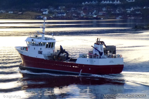
Viking Saga
Current StatusWhere is the vessel?
Viking Saga is currently in Near Honningsvåg, based on AIS data received less than 1h ago.
Latest AIS update:
Current position: 70.93484° N, 25.81904° E (Near Honningsvåg)
Average speed (last 7 days): Loading…
Average speed (last 30 days): Loading…
Vessel profile: Viking Saga is a Fish Carrier with dimensions 9m x 42m.
This page combines live AIS, route history, probable destination signals, nearby traffic, and port activity for practical vessel monitoring.
The current position of vessel Viking Saga is 70.93484 lat / 25.81904 lng. Updated: 2026-05-14 16:07:59 UTCNearest reference points:
- Near HONNINGSVAAG
- Near SKARSVAG
- Near KJOLLEFJORD
Details:
Live Vessel Viking Saga Analytics (details, animations, etc.)
Recent AIS points (UTC):
2026-05-14 13:33:37 UTC · 71.10843, 27.05982 · SOG 9.6 kn · COG 244°2026-05-14 13:53:59 UTC · 71.08626, 26.90518 · SOG 10.1 kn · COG 243°
2026-05-14 16:04:38 UTC · 70.93675, 25.84897 · SOG 10.8 kn · COG 257°
2026-05-14 16:07:59 UTC · 70.93484, 25.81904 · SOG 10.7 kn · COG 258°