 vesseltracker.com
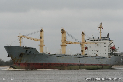
Le Tong
Current StatusWhere is the vessel?
Le Tong is currently in Near Tianjin Pt, based on AIS data received about 661d ago.
Latest AIS update:
Current position: 38.96712° N, 117.78903° E (Near Tianjin Pt)
Average speed (last 7 days): Loading…
Average speed (last 30 days): Loading…
Vessel profile: Le Tong is a General Cargo Ship with dimensions 25m x 169m.
This page combines live AIS, route history, probable destination signals, nearby traffic, and port activity for practical vessel monitoring.
The current position of vessel Le Tong is 38.96712 lat / 117.78903 lng. Updated: 2024-07-22 19:43:02 UTCNearest reference points:
- Near Tianjin Pt
- Near Tianjin Xingang Pt
- Near Dagu
Details:
Live Vessel Le Tong Analytics (details, animations, etc.)
Recent AIS points (UTC):
2024-07-22 19:43:02 UTC · 38.96712, 117.78903 · SOG 0 kn · COG 279°