 vesseltracker.com
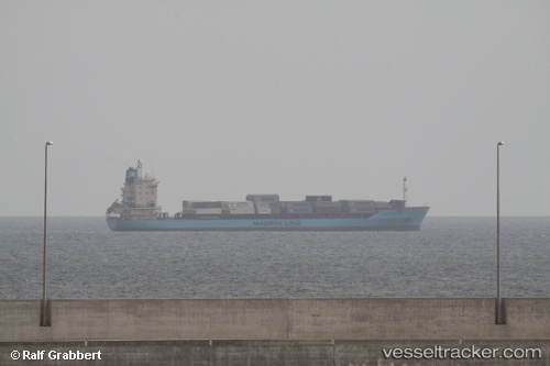
 Maersk Atlantic
Current Status
Where is the vessel?
Maersk Atlantic is currently in 12 nm NW of Free Port, based on AIS data received about 1082d ago.
Latest AIS update:
Current position: 25.37016° N, 55.07296° E (12 nm NW of Free Port)
Average speed (last 7 days): Loading…
Average speed (last 30 days): Loading…
Vessel profile: Maersk Atlantic is a Container Ship with dimensions 155m x 25m.
This page combines live AIS, route history, probable destination signals, nearby traffic, and port activity for practical vessel monitoring.
The current position of vessel Maersk Atlantic is 25.37016 lat / 55.07296 lng. Updated: 2023-05-28 08:23:55 UTCNearest reference points:
- Near Free Port
- 17 nm NW of Free Port
- Near DUBAI
Currently sailing under the flag of Hong Kong ![]()
Maersk Atlantic built in 1999 year
Deadweight:
17733 tDetails:
Live Vessel Maersk Atlantic Analytics (details, animations, etc.)
Recent AIS points (UTC):
2023-05-28 08:23:55 UTC · 25.37016, 55.07296 · SOG 0.3 kn · COG 252°