 vesseltracker.com
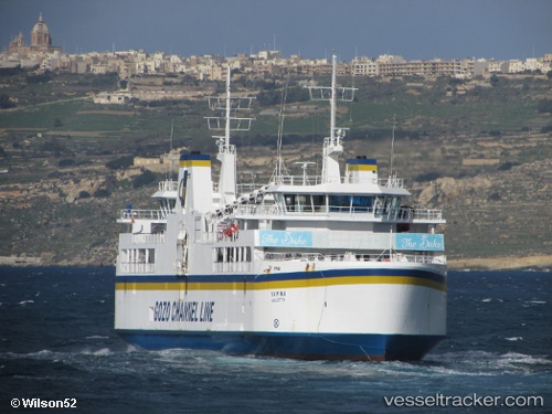
 Ta Pinu
Current Status
Where is the vessel?
Ta Pinu is currently in Near CIRKEWWA, based on AIS data received less than 1h ago.
Latest AIS update:
Current position: 35.98959° N, 14.32973° E (Near CIRKEWWA)
Average speed (last 7 days): Loading…
Average speed (last 30 days): Loading…
Vessel profile: Ta Pinu is a Passenger Ro Ro Cargo Ship with dimensions m x m.
This page combines live AIS, route history, probable destination signals, nearby traffic, and port activity for practical vessel monitoring.
The current position of vessel Ta Pinu is 35.98959 lat / 14.32973 lng. Updated: 2026-05-14 08:25:03 UTCNearest reference points:
- Near CIRKEWWA
- Near Saint Julians
- Near Sliema
Currently sailing under the flag of Malta ![]()
Ta Pinu built in 2000 year
Deadweight:
1064 tDetails:
Live Vessel Ta Pinu Analytics (details, animations, etc.)
Recent AIS points (UTC):
2026-05-14 04:35:32 UTC · 36.02382, 14.29901 · SOG 0 kn · COG 231°2026-05-14 05:44:24 UTC · 36.02386, 14.29905 · SOG 0 kn · COG 229°
2026-05-14 08:01:43 UTC · 36.00233, 14.31696 · SOG 10.2 kn · COG 318°
2026-05-14 08:25:03 UTC · 35.98959, 14.32973 · SOG 0 kn · COG 50°