 vesseltracker.com
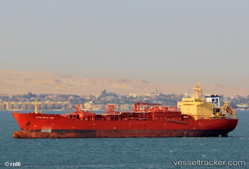
 GREAT SAIL
Current Status
Where is the vessel?
GREAT SAIL is currently in 100 nm NE of SUR, based on AIS data received about 2h ago.
Latest AIS update:
Current position: 23.31167° N, 61.14500° E (100 nm NE of SUR)
Average speed (last 7 days): Loading…
Average speed (last 30 days): Loading…
Vessel profile: GREAT SAIL is a Lpg Tanker with dimensions m x m.
This page combines live AIS, route history, probable destination signals, nearby traffic, and port activity for practical vessel monitoring.
The current position of vessel GREAT SAIL is 23.31167 lat / 61.14500 lng. Updated: 2026-05-15 11:06:27 UTCNearest reference points:
- 97 nm S of Chabahar
- 96 nm E of SUR
- 52 nm NE of SUR
Currently sailing under the flag of Barbados ![]()
Details:
Live Vessel GREAT SAIL Analytics (details, animations, etc.)
Recent AIS points (UTC):
2026-05-15 08:18:23 UTC · 23.43500, 61.11833 · SOG 13 kn · COG -1°2026-05-15 09:36:29 UTC · 23.30167, 61.12500 · SOG 0 kn · COG -1°
2026-05-15 10:18:30 UTC · 23.30667, 61.13333 · SOG 0 kn · COG -1°
2026-05-15 11:06:27 UTC · 23.31167, 61.14500 · SOG 0 kn · COG -1°