 vesseltracker.com
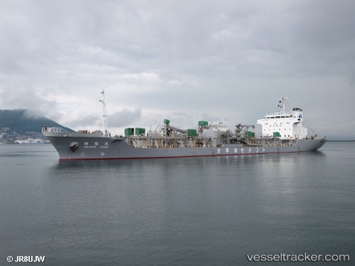
 Rikuryu Maru
Current Status
Where is the vessel?
Rikuryu Maru is currently in 17 nm S of ONAHAMA, based on AIS data received less than 1h ago.
Latest AIS update:
Current position: 36.65667° N, 141.01334° E (17 nm S of ONAHAMA)
Average speed (last 7 days): Loading…
Average speed (last 30 days): Loading…
Vessel profile: Rikuryu Maru is a Cement Carrier with dimensions 135m x 20m.
This page combines live AIS, route history, probable destination signals, nearby traffic, and port activity for practical vessel monitoring.
The current position of vessel Rikuryu Maru is 36.65667 lat / 141.01334 lng. Updated: 2026-04-25 15:23:15 UTCNearest reference points:
- Near Mito
- 31 nm NE of ONAHAMA
- 32 nm NE of ONAHAMA
Currently sailing under the flag of Japan ![]()
Rikuryu Maru built in 1997 year
Deadweight:
10836 tDetails:
Live Vessel Rikuryu Maru Analytics (details, animations, etc.)
Recent AIS points (UTC):
2026-04-25 11:28:07 UTC · 35.82529, 140.94019 · SOG 12.5 kn · COG 6°2026-04-25 13:40:16 UTC · 36.29285, 140.97723 · SOG 12.6 kn · COG 6°
2026-04-25 13:56:44 UTC · 36.34989, 140.98447 · SOG 12.5 kn · COG 3°
2026-04-25 15:23:15 UTC · 36.65667, 141.01334 · SOG 12 kn · COG -1°