 vesseltracker.com
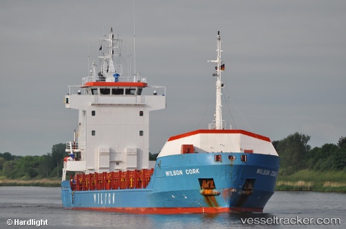
 Wilson Cork
Current Status
Where is the vessel?
Wilson Cork is currently in 26 nm NW of Pierowall, Westray, based on AIS data received less than 1h ago.
Latest AIS update:
Current position: 59.58298° N, 3.68206° W (26 nm NW of Pierowall, Westray)
Average speed (last 7 days): Loading…
Average speed (last 30 days): Loading…
Vessel profile: Wilson Cork is a Multi Purpose Carrier with dimensions 100m x 13m.
This page combines live AIS, route history, probable destination signals, nearby traffic, and port activity for practical vessel monitoring.
The current position of vessel Wilson Cork is 59.58298 lat / -3.68206 lng. Updated: 2026-05-15 01:12:30 UTCNearest reference points:
- Near STROMNESS
- Near Tingwall
- 36 nm NW of Ham Voe, Foula
Currently sailing under the flag of Barbados ![]()
Wilson Cork built in 1998 year
Deadweight:
4444 tDetails:
Live Vessel Wilson Cork Analytics (details, animations, etc.)
Recent AIS points (UTC):
2026-05-14 22:25:02 UTC · 59.45600, -3.81602 · SOG 4 kn · COG 25°2026-05-14 22:58:53 UTC · 59.48269, -3.78654 · SOG 2.9 kn · COG 27°
2026-05-14 23:49:13 UTC · 59.52307, -3.75204 · SOG 3.2 kn · COG 28°
2026-05-15 01:12:30 UTC · 59.58298, -3.68206 · SOG 3 kn · COG 30°