 vesseltracker.com
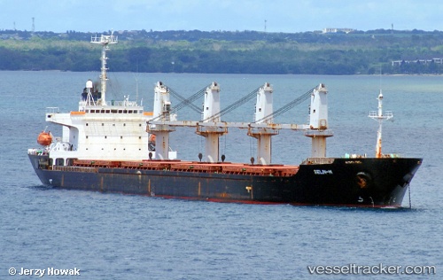
Selin M
Current StatusWhere is the vessel?
Selin M is currently in 36 nm N of Mellitah (Qasr Ahmed), based on AIS data received less than 1h ago.
Latest AIS update:
Current position: 33.16833° N, 15.54667° E (36 nm N of Mellitah (Qasr Ahmed))
Average speed (last 7 days): Loading…
Average speed (last 30 days): Loading…
Vessel profile: Selin M is a Bulk Carrier with dimensions 29m x 176m.
This page combines live AIS, route history, probable destination signals, nearby traffic, and port activity for practical vessel monitoring.
The current position of vessel Selin M is 33.16833 lat / 15.54667 lng. Updated: 2026-05-02 18:13:41 UTCNearest reference points:
- Near MISURATA
Details:
Live Vessel Selin M Analytics (details, animations, etc.)
Recent AIS points (UTC):
2026-05-02 13:19:32 UTC · 32.83333, 14.67667 · SOG 11 kn · COG -1°2026-05-02 15:31:38 UTC · 32.98833, 15.08667 · SOG 10 kn · COG -1°
2026-05-02 16:19:43 UTC · 33.04333, 15.22667 · SOG 9 kn · COG -1°
2026-05-02 18:13:41 UTC · 33.16833, 15.54667 · SOG 9 kn · COG -1°