 vesseltracker.com
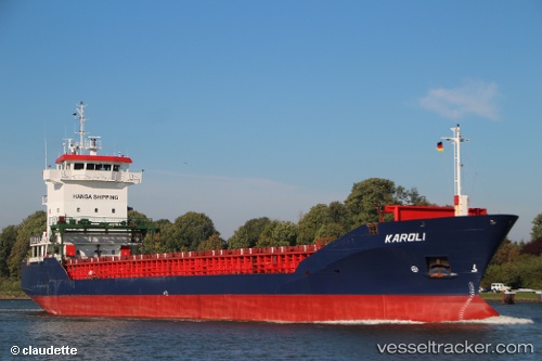
 KAROLI
Current Status
Where is the vessel?
KAROLI is currently in Near Zandvliet, based on AIS data received about 2h ago.
Latest AIS update:
Current position: 51.35919° N, 4.28730° E (Near Zandvliet)
Average speed (last 7 days): Loading…
Average speed (last 30 days): Loading…
Vessel profile: KAROLI is a General Cargo with dimensions m x m.
This page combines live AIS, route history, probable destination signals, nearby traffic, and port activity for practical vessel monitoring.
The current position of vessel KAROLI is 51.35919 lat / 4.28730 lng. Updated: 2026-05-16 10:03:02 UTCNearest reference points:
- Near Doel
- Near Kallo
- Near Rilland
Currently sailing under the flag of Antigua and Barbuda ![]()
Details:
Live Vessel KAROLI Analytics (details, animations, etc.)
Recent AIS points (UTC):
2026-05-16 07:28:57 UTC · 51.35905, 4.28732 · SOG 0 kn · COG 276°2026-05-16 07:42:05 UTC · 51.35905, 4.28730 · SOG 0 kn · COG 276°
2026-05-16 09:33:57 UTC · 51.35907, 4.28728 · SOG 0 kn · COG 276°
2026-05-16 10:03:02 UTC · 51.35919, 4.28730 · SOG 0.2 kn · COG 257°