 vesseltracker.com
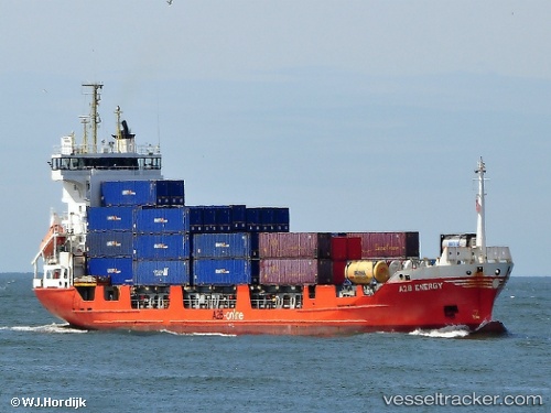
 A2b Energy
Current Status
Where is the vessel?
A2b Energy is currently in Near MOERDIJK, based on AIS data received less than 1h ago.
Latest AIS update:
Current position: 51.68028° N, 4.59438° E (Near MOERDIJK)
Average speed (last 7 days): Loading…
Average speed (last 30 days): Loading…
Vessel profile: A2b Energy is a Container Ship with dimensions 101m x 101m.
This page combines live AIS, route history, probable destination signals, nearby traffic, and port activity for practical vessel monitoring.
The current position of vessel A2b Energy is 51.68028 lat / 4.59438 lng. Updated: 2026-05-18 03:42:52 UTCNearest reference points:
- Near MOERDIJK
- Near STRIJENSAS
- Near Mookhoek
Currently sailing under the flag of Netherlands ![]()
A2b Energy built in 1998 year
Deadweight:
5356 tDetails:
Live Vessel A2b Energy Analytics (details, animations, etc.)
Recent AIS points (UTC):
2026-05-17 23:21:50 UTC · 51.68008, 4.59444 · SOG 0 kn · COG 164°2026-05-18 01:45:51 UTC · 51.68027, 4.59448 · SOG 0 kn · COG 164°
2026-05-18 02:12:50 UTC · 51.68027, 4.59438 · SOG 0 kn · COG 164°
2026-05-18 03:42:52 UTC · 51.68028, 4.59438 · SOG 0 kn · COG 164°