 vesseltracker.com
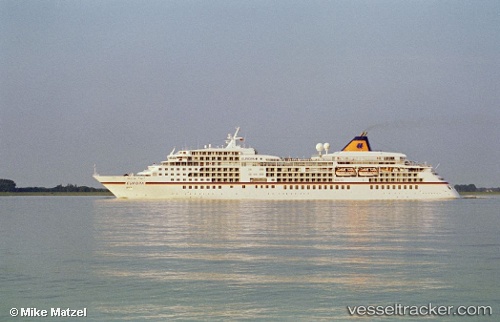
 EUROPA
Current Status
Where is the vessel?
EUROPA is currently in 16 nm E of Cabanas, based on AIS data received less than 1h ago.
Latest AIS update:
Current position: 43.50940° N, 8.48297° E (16 nm E of Cabanas)
Average speed (last 7 days): Loading…
Average speed (last 30 days): Loading…
Vessel profile: EUROPA is a Passenger (Cruise) Ship with dimensions 199m x 26m.
This page combines live AIS, route history, probable destination signals, nearby traffic, and port activity for practical vessel monitoring.
The current position of vessel EUROPA is 43.5094 lat / 8.48297 lng. Updated: 2026-05-14 23:58:05 UTCNearest reference points:
- 20 nm SE of Cabanas
- Near Diano Marina
- Near MARINA DI ANDORA
Currently sailing under the flag of Malta ![]()
EUROPA built in 1999 year
Deadweight:
2557 tDetails:
Live Vessel EUROPA Analytics (details, animations, etc.)
Recent AIS points (UTC):
2026-05-14 20:02:11 UTC · 43.73630, 7.43127 · SOG 0 kn · COG 40°2026-05-14 22:00:41 UTC · 43.67260, 7.76832 · SOG 17.1 kn · COG 103°
2026-05-14 22:35:35 UTC · 43.62860, 7.98202 · SOG 16.5 kn · COG 105°
2026-05-14 23:58:05 UTC · 43.50940, 8.48297 · SOG 17.1 kn · COG 108°