 vesseltracker.com
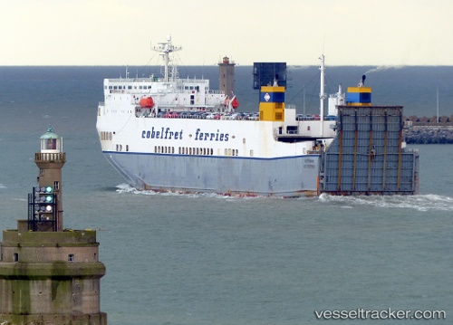
 VICTORINE
Current Status
Where is the vessel?
VICTORINE is currently in Near Sangatte, based on AIS data received less than 1h ago.
Latest AIS update:
Current position: 51.01499° N, 1.63020° E (Near Sangatte)
Average speed (last 7 days): Loading…
Average speed (last 30 days): Loading…
Vessel profile: VICTORINE is a Ro-Ro Cargo with dimensions m x m.
This page combines live AIS, route history, probable destination signals, nearby traffic, and port activity for practical vessel monitoring.
The current position of vessel VICTORINE is 51.01499 lat / 1.63020 lng. Updated: 2026-05-14 22:37:26 UTCNearest reference points:
- Near Sangatte
- Near Dover
- 14 nm SE of RAMSGATE
Currently sailing under the flag of Malta ![]()
Details:
Live Vessel VICTORINE Analytics (details, animations, etc.)
Recent AIS points (UTC):
2026-05-14 19:45:18 UTC · 50.49482, 0.99192 · SOG 13.5 kn · COG 52°2026-05-14 20:04:40 UTC · 50.53952, 1.08607 · SOG 14 kn · COG 49°
2026-05-14 22:01:08 UTC · 50.89955, 1.50135 · SOG 14.1 kn · COG 38°
2026-05-14 22:37:26 UTC · 51.01499, 1.63020 · SOG 14 kn · COG 29°