 vesseltracker.com
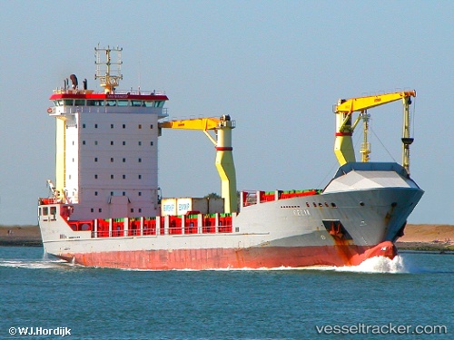
 Imua Ii
Current Status
Where is the vessel?
Imua Ii is currently in Near Apia, based on AIS data received less than 1h ago.
Latest AIS update:
Current position: 13.70752° S, 171.83884° W (Near Apia)
Average speed (last 7 days): Loading…
Average speed (last 30 days): Loading…
Vessel profile: Imua Ii is a Multi Purpose Carrier with dimensions 120m x 18m.
This page combines live AIS, route history, probable destination signals, nearby traffic, and port activity for practical vessel monitoring.
The current position of vessel Imua Ii is -13.70752 lat / -171.83884 lng. Updated: 2026-05-14 23:31:51 UTCCurrently sailing under the flag of Antigua Barbuda ![]()
Details:
Live Vessel Imua Ii Analytics (details, animations, etc.)
Recent AIS points (UTC):
2026-05-14 19:37:00 UTC · -14.00247, -172.63686 · SOG 12.7 kn · COG 67°2026-05-14 21:58:27 UTC · -13.80187, -172.16299 · SOG 14 kn · COG 58°
2026-05-14 23:04:01 UTC · -13.71140, -171.93962 · SOG 12.7 kn · COG 80°
2026-05-14 23:31:51 UTC · -13.70752, -171.83884 · SOG 12.6 kn · COG 90°