 vesseltracker.com
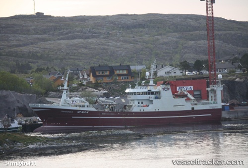
 Troenderbas
Current Status
Where is the vessel?
Troenderbas is currently in Near RAUDEBERG, based on AIS data received less than 1h ago.
Latest AIS update:
Current position: 61.98493° N, 5.14076° E (Near RAUDEBERG)
Average speed (last 7 days): Loading…
Average speed (last 30 days): Loading…
Vessel profile: Troenderbas is a Fish Carrier with dimensions 68m x 14m.
This page combines live AIS, route history, probable destination signals, nearby traffic, and port activity for practical vessel monitoring.
The current position of vessel Troenderbas is 61.98493 lat / 5.14076 lng. Updated: 2026-05-16 07:26:46 UTCNearest reference points:
- Near RAUDEBERG
- Near MALOY
- Near Gursken
Currently sailing under the flag of Norway ![]()
Troenderbas built in 1999 year
Details:
Live Vessel Troenderbas Analytics (details, animations, etc.)
Recent AIS points (UTC):
2026-05-16 03:20:44 UTC · 61.98501, 5.14072 · SOG 0 kn · COG -1°2026-05-16 04:01:56 UTC · 61.98503, 5.14078 · SOG 0 kn · COG -1°
2026-05-16 05:26:52 UTC · 61.98499, 5.14072 · SOG 0 kn · COG -1°
2026-05-16 07:26:46 UTC · 61.98493, 5.14076 · SOG 0 kn · COG -1°