 vesseltracker.com
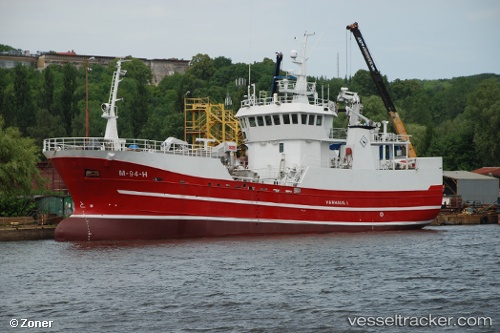
Harhaug 1
Current StatusWhere is the vessel?
Harhaug 1 is currently in Near SOVIK, based on AIS data received about 1h ago.
Latest AIS update:
Current position: 62.55557° N, 6.26589° E (Near SOVIK)
Average speed (last 7 days): Loading…
Average speed (last 30 days): Loading…
Vessel profile: Harhaug 1 is a Fishing Vessel with dimensions 9m x 41m.
This page combines live AIS, route history, probable destination signals, nearby traffic, and port activity for practical vessel monitoring.
The current position of vessel Harhaug 1 is 62.55557 lat / 6.26589 lng. Updated: 2026-04-24 16:17:04 UTCNearest reference points:
- Near Brattvåg
- Near SPJELKAVIK
- Near Alesund
Details:
Live Vessel Harhaug 1 Analytics (details, animations, etc.)
Recent AIS points (UTC):
2026-04-24 13:41:11 UTC · 62.55560, 6.26587 · SOG 0 kn · COG 285°2026-04-24 14:02:05 UTC · 62.55564, 6.26583 · SOG 0 kn · COG 285°
2026-04-24 16:10:55 UTC · 62.55559, 6.26581 · SOG 0 kn · COG 286°
2026-04-24 16:17:04 UTC · 62.55557, 6.26589 · SOG 0 kn · COG 285°