 vesseltracker.com
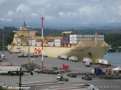
 Dole Colombia
Current Status
Where is the vessel?
Dole Colombia is currently in 54 nm NE of Isleta, based on AIS data received about 1h ago.
Latest AIS update:
Current position: 16.16630° N, 85.46431° W (54 nm NE of Isleta)
Average speed (last 7 days): Loading…
Average speed (last 30 days): Loading…
Vessel profile: Dole Colombia is a Container Ship with dimensions 205m x 32m.
This page combines live AIS, route history, probable destination signals, nearby traffic, and port activity for practical vessel monitoring.
The current position of vessel Dole Colombia is 16.16630 lat / -85.46431 lng. Updated: 2026-05-12 21:59:29 UTCNearest reference points:
- 26 nm SE of Dangriga
Currently sailing under the flag of Bahamas ![]()
Dole Colombia built in 1999 year
Deadweight:
30145 tDetails:
Live Vessel Dole Colombia Analytics (details, animations, etc.)
Recent AIS points (UTC):
2026-05-12 18:32:52 UTC · 15.96809, -84.51258 · SOG 18.4 kn · COG 281°2026-05-12 19:27:32 UTC · 16.06703, -84.78280 · SOG 18.6 kn · COG 295°
2026-05-12 21:16:34 UTC · 16.17055, -85.32658 · SOG 18.1 kn · COG 263°
2026-05-12 21:59:29 UTC · 16.16630, -85.46431 · SOG 16.2 kn · COG 189°